
Airport Weather Map
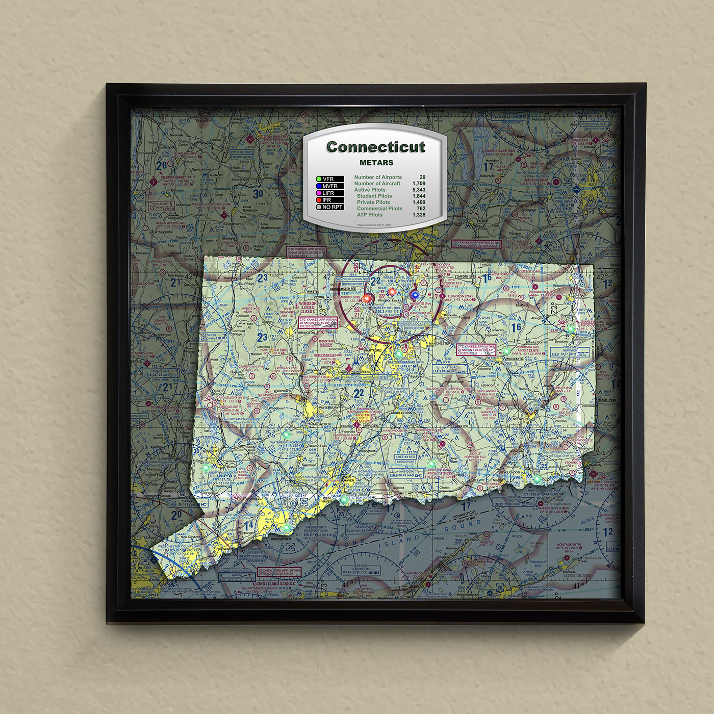
State METAR Map - Connecticut
State METAR Map - Connecticut
Regular price
$495.00 USD
Regular price
$395.00 USD
Sale price
$495.00 USD
Unit price
per
Couldn't load pickup availability
Connecticut State METAR Map. Get your own state map showing METARs for all the major airports. This map of Connecticut is easy to set up and comes with a lifetime warranty. It is 23" x 23" and has the power outlet on the back, so you can mount it on the wall over an outlet to hide the power cord if desired.
Materials
Materials
Shipping & Returns
Shipping & Returns
Free Shipping
Dimensions
Dimensions
Custom Maps: 24" X 30"
State Maps: 23" X 23"
Care Instructions
Care Instructions
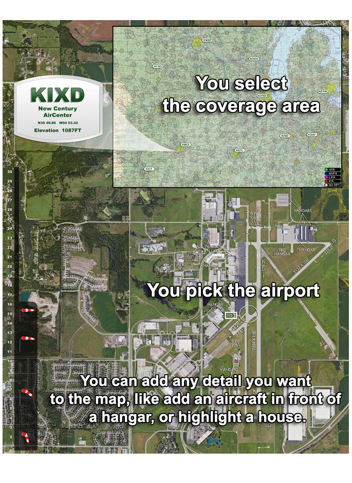
Here's How Custom Maps are Ordered
- First, pick your airport. Example: KOSH
- Pick the general area you would like to show in the sectional. Example: show Denver and St Lous east-west, Chicago and Wichita, north-south. Or, KDEN-KSTL, KORD-KICT. Or, show entire lower 48.
- Add those details in the "special instructions" section in the cart when you checkout.
- Purchase the map.
- When we recieve the order, we create a mockup that shows the aerial view of the airport and the layout of the sectional, wind sock and display.
- You then make changes to the original proof (if necessary), and we continue this process until you approve the design
- We then create your custom map and ship it to you.
- The whole process takes about 2 weeks.
NOTE: Your sectional is limited to 25 METARs in LEDs. Any additional METAR is $5 each.
-
Free Shipping
All of our custom Airport Weather Maps ship free to any location in the lower 48 states. Additional cost for Alaska and Hawaii.
-
Lifetime Warranty
If your Airport Weather Map has any issues at all, we are there to help. We can work with you by replacing any defective parts, and even ship out a new Map is necessary.